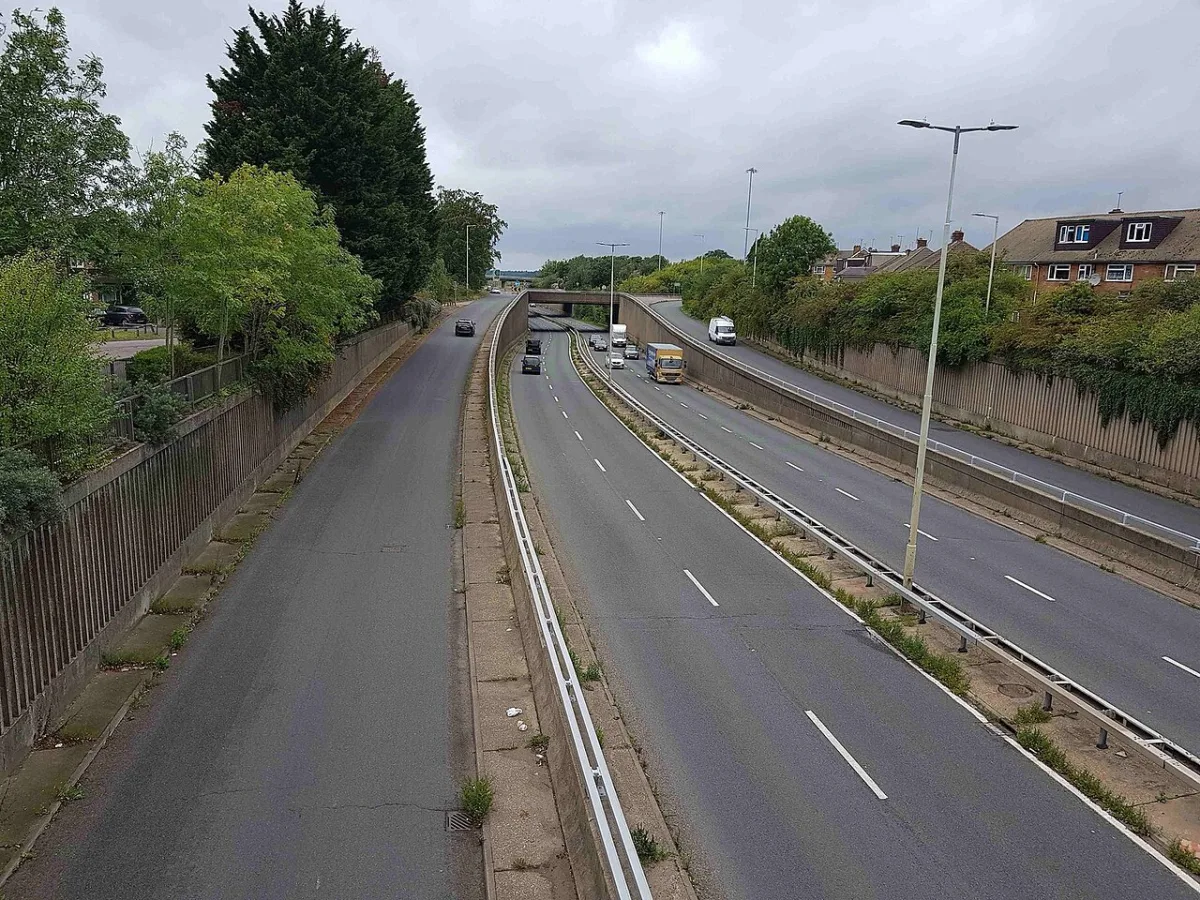

The A4008 Stephenson Way shuts for 10 days from 6 October, and the M1 northbound closes overnight to Watford's own junction on four more nights.
The A4008 Stephenson Way closes completely for 10 days from Tuesday 6 October, along its whole length from the M1 junction 5 roundabout to the Waterfields Way roundabout. That is 2,430 metres of the road most Watford drivers use to reach the motorway, and the Colonial Way roundabout goes with it.
That is the biggest item on the Watford roadworks list for the fortnight ahead. The order is not on any council web page. It was advertised in the Watford Observer on 18 September and is on the Public Notice Portal. More detail below.
Before then, the M1 northbound is shut to Watford’s own junction on four more nights. The closure runs from junction 1 at Brent Cross all the way to junction 5 at Berrygrove, and it is booked for the nights of Wednesday 23, Thursday 24, Friday 25 and Monday 28 September.
Motorways: what is shut overnight
National Highways published its current seven-day closure report at 15:30 on Tuesday 22 September, covering Tuesday 22 to Monday 28 September. Six closures in it matter for Watford and Rickmansworth.
| Where | What | When |
|---|---|---|
| M1 northbound, junction 1 to junction 5 | Carriageway closure for surfacing, from Brent Cross to Watford's own junction at Berrygrove. Diversion via local authority roads, route not published | 22:00 to 05:30 on the nights of Wednesday 23, Thursday 24 and Monday 28 September, and 23:00 to 06:00 on Friday 25 September |
| M25 anticlockwise, junction 21a to junction 20 | Carriageway and link road closure for cyclical maintenance. It takes out junction 21 as well, and ends at the Kings Langley junction the A41 from Watford feeds | 22:00 to 05:30 on the nights of Wednesday 23 and Thursday 24 September |
| M25 clockwise, junction 17 to junction 18 | Carriageway, slip road and lane closure for electrical works. These are the Maple Cross and Chorleywood junctions, the Rickmansworth end of the motorway | 22:00 to 05:30 on the nights of Wednesday 23 and Thursday 24 September |
| M25 clockwise junction 21a, and the M1 southbound link road onto it | Carriageway and lane closure for maintenance. Diversion is up and over the junction, or M1 southbound junction 6a to 6 and the A405 northbound back to junction 21a | 23:00 to 06:00 on the night of Friday 25 September |
| M1 junction 8 entry slips, northbound and southbound | Slip road closures, part of the junction 6a to 8 resurfacing scheme | 22:00 to 05:00 on the night of Sunday 27 September |
| M1 southbound, junction 11a to junction 9 | Carriageway closure for communications work, north of Watford beyond Hemel Hempstead | 22:00 to 05:00 on the night of Saturday 26 September |
Three things in that list are worth a second look.
The M1 northbound closure has grown from one night to four. Last week’s report booked it for the night of Monday 21 September only. The current edition has it on four of the six nights, and it is the longest stretch of motorway shut anywhere near the town: junctions 1 to 5, the whole run from Brent Cross to Berrygrove. National Highways gives no diversion route beyond “via local authorities”.
Wednesday and Thursday take out both ends of the M25 near Watford at once. Anticlockwise, the closure from junction 21a to junction 20 removes junction 21 in between and stops at Kings Langley. Clockwise, junctions 17 to 18 closes the Maple Cross and Chorleywood stretch. If you drive home from Heathrow or the M40 late on either night, check the span before you set off.
Saturday 26 September is the only clear night near Watford. The report is revised during the week, so check it again before a late drive.
The M1 southbound closure at Watford’s junction has not been booked
A statutory notice, reference NH/SE/2026/M1/72, was advertised in the Watford Observer on 11 September. It authorises overnight closure of the M1 southbound between junction 6a and junction 5 at Berrygrove, plus every slip road on that length, between 21:00 and 06:00, expected to start on 26 September 2026 and last about two weeks. The published diversion sends M1 traffic anticlockwise round the M25 to junction 20, then east along the A41 past Watford to junction 5.
That closure is not in this week’s National Highways report. Nothing is booked M1 southbound between junctions 6a and 5 on any of the three nights from Saturday 26 to Monday 28 September. A notice sets the outer limit of what may be closed; it does not commit the agency to a date. So treat 26 September as the earliest it can begin, not as a fixture, and watch the closure report rather than the notice. National Highways gives 0300 123 5000 for enquiries.
The A4008 Stephenson Way closes for 10 days from 6 October
This is the biggest Watford street closure on the books, and it exists only in a statutory notice published on 18 September.
Hertfordshire County Council intends to close, from Tuesday 6 October and for works scheduled to take 10 days:
- A4008 Stephenson Way, from the A41 North Western Avenue and M1 junction 5 roundabout to the A411 Waterfields Way roundabout, about 2,430 metres
- the Colonial Way roundabout, Bushey, for its entire length
- the A4008 Stephenson Way link road at Bushey, about 459 metres
- the A411 Beechen Grove link road, Watford, to Stephenson Way, about 190 metres
- the A4008 Stephenson Way link road, Watford, down to the Waterfields Way roundabout, about 169 metres
Waiting is banned on both sides of all of them while works are in progress. The notice does not say what the works are. Queries go to Hertfordshire County Council on 0300 123 4047.
The published diversion is a long way round. It runs via the A41 Otterspool Way, Elton Way and Tylers Way, the A411 Elstree Road, Sparrows Herne, High Street, London Road and Chalk Hill, the A4008 Aldenham Road and Pinner Road, and the A411 Lower High Street, Dalton Way and Waterfields Way, or the same loop in reverse.
That matters because Stephenson Way is the road most people use to reach the M1, and because the diversion is routed along Chalk Hill and through Bushey, which have had closures of their own this autumn. As always, the order only bites on the days and times shown on signs on the road, and “intends to make” means the date can still move.
Watford street closures
These are statutory temporary traffic orders from Hertfordshire County Council, the highway authority for every road in the borough except the M1 and M25. Each gives a start date and how long the works should take. None runs continuously for that whole period.
| Road | Extent | From | Works expected to take | Status and reason |
|---|---|---|---|---|
| A411 Chalk Hill, Watford, and A411 London Road, High Street and Sparrows Herne, Bushey | B462 Aldenham Road to A411 Elstree Road, about 1,840m, waiting banned both sides | 14 September | 18 days | Made. Reason not stated |
| Falconer Road, Bushey | Finch Lane to A411 High Street, about 398m, except for access | 14 September | 4 weeks | Made. Utility works |
| A411 Elstree Road and Watford Road, Elstree, with a 30mph limit on the A41 Tylers Way roundabout at Bushey Heath | About 899m closed from Aldenham Road, plus a 30mph limit over 1,470m of the A411 and 207m of the roundabout | 7 September | 131 days | Made. Utility works |
| Sandringham Road, Watford | Balmoral Road to Buckingham Road, about 395m, except for access | 24 September | 1 day | Made. Sewer cleaning |
| A41 Elton Way, Bushey | About 52m, starting 148m south east of the B462 Hartspring Lane roundabout | 26 September | 5 days | Intended. Reason not stated |
| Cycle lane, A412 St Albans Road, Watford | East side, about 31m from No.142 south to the Hille Business Centre access. Cyclists dismount | 28 September | 5 nights | Intended. Advertising panel replacement |
| Footpath beside No.26 Nottingham Close, Watford | About 25m, no alternative route | 28 September | 3 days | Intended. Utility works |
| A411 Sparrows Herne, Bushey | Chestnut Rise to Police Station Lane, about 193m, except for access | 4 October | 1 day | Intended. Reason not stated |
| Muirfield Road, South Oxhey | Oxhey Drive to Northwick Road, about 1,284m, except for access, waiting banned both sides | 5 October | 5 days | Intended. Reason not stated |
| Footbridges over the A404 Chorleywood Road and the A412 Park Road, Rickmansworth, and Batchworth Footpath No.029 | 45m and 26m of footbridge and 18m of footpath, closed to pedestrians, no alternative route | 5 October | 5 days | Intended. Footbridge refurbishment |
| A4008 Stephenson Way, the Colonial Way roundabout and three link roads, Watford and Bushey | M1 junction 5 roundabout to the A411 Waterfields Way roundabout, about 2,430m, plus 459m, 190m and 169m of link road | 6 October | 10 days | Intended. Reason not stated |
Three notes on that table.
Chalk Hill should be finishing. The order took effect on 14 September with works scheduled to take 18 days, so the signs should come down in early October. Its 1,840 metres of the A411 through Bushey is also part of the published diversion for the Stephenson Way closure that starts on 6 October, so the two need to miss each other.
Sandringham Road is now a made order, not an intended one. The 18 September notice confirms it as Order No.2 2026, in effect from 24 September for a single day of sewer cleaning in north Watford. The way round is via Balmoral Road, the A412 St Albans Road and Bushey Mill Lane.
Rickmansworth loses two footbridges for five days from 5 October. The notice says there is no alternative route for either, and that access will be maintained wherever possible. The contractor is Octavius Infrastructure, on 07392 094426.
The 4 September notice, the 11 September notice and the 18 September notice carry the full extents, diversions and contractor phone numbers.
Trains from Watford
The Oxhey Grange footbridge is gone, and the line reopened early. Network Rail lifted the deteriorated footbridge out over the weekend of 20 September and handed the West Coast Main Line back before the advertised 4pm on the Sunday. The bridge came out in a single lift using a 1,200 tonne crane capable of lifting 100 tonnes, which Network Rail says shortened the closure compared with other methods. Its statement of 21 September says it will “continue to engage with local stakeholders as plans for a future replacement crossing are developed”. There is still no date for a replacement, and the bridge linked Oxhey Grange with The Pathway and Anthony Close.
Today, Wednesday 23 September: the Lioness line and the Metropolitan line are both running a good service, according to TfL’s status feed. No National Rail engineering notice names Watford Junction or Bushey today.
Coming up at the Watford end of the line, from National Rail’s engineering pages:
- Saturday 26 and Sunday 27 September: no Southern trains between Shepherd’s Bush and Watford Junction from 19:45 on the Saturday until 12:00 on the Sunday, and again after 20:00 on the Sunday. London Northwestern tickets are accepted between Euston and Watford Junction, and there is paper ticket acceptance on the Bakerloo line between Oxford Circus and Harrow and Wealdstone until 13:00 on the Sunday.
- The same weekend at Bushey: the 22:21 and 23:30 from Euston on the Saturday, and the 00:09 and 23:40 on the Sunday, do not call there. Until 12:00 on the Sunday, Euston to Northampton and Birmingham trains skip Bushey or stop to set down only.
TfL’s planned closures schedule also lists the whole Lioness line closed on Saturday 21 and Sunday 22 November, and the Metropolitan line closed between Harrow-on-the-Hill and Watford from Thursday 18 to Sunday 21 February 2027.
What parking costs
Watford Borough Council runs the town centre car parks. The tariffs below come from the council’s own car park directory records, read again on 23 September 2026 and unchanged since August.
| Stay | The Avenue | Town Hall, Mon to Fri | Town Hall, Sat and Sun |
|---|---|---|---|
| Up to 1 hour | £1.10 | £1.20 | £1.20 |
| Up to 2 hours | £2.20 | £2.30 | £2.30 |
| Up to 3 hours | £3.30 | £3.40 | £3.40 |
| Up to 4 hours | £4.40 | £4.50 | £4.50 |
| All day, 7am to midnight | £6.60 | £6.70 for 4 hours or more | £6.70 |
| Evening flat rate | None listed | None. The hourly scale runs on after 5pm | None |
| Spaces | 119, with 6 Blue Badge bays and 2 EV chargers | 115, with 6 Blue Badge bays and 2 EV chargers | |
| Season ticket | £478.50 for 6 months | Staff only | Staff only |
Permit parking is being extended into Balmoral Road, and you have until 9 October to object. Watford Borough Council published a notice of proposal on 18 September to bring Balmoral Road, between St Albans Road and Bradshaw Road, into the Callowland zone NA permit parking area. On the south side, next to numbers 2 to 46, parking would become permit holders only from 8am to 10am and 5pm to 10pm, Monday to Saturday. Properties at 1 to 48 Balmoral Road that meet the criteria would be able to buy permits, and the notice prints the prices: £36 for a first resident’s permit, £76 for a second (£36 for a motorcycle), 30p an hour or £2 a day for a visitor permit, and £10 a week for a virtual one. Objections and representations of support go to parkingconsultation@watford.gov.uk by 23:59 on 9 October 2026.
A separate proposal would ban waiting at any time on parts of Richfield Road in Bushey. Hertfordshire County Council is consulting on it under reference H00426, and objections go to tro.team@hertfordshire.gov.uk by the same date, 9 October.
You can pay with more than one app. Watford Borough Council joined the National Parking Platform on 7 September, and its own listing there names six approved apps for the borough: APCOA Parking, AppyParking, Caura, JustPark, RingGo and PayByPhone. The council’s individual car park pages still show RingGo alone, so check the platform’s own Watford listing if you want to use a different one. We have the full list and what changed.
The old £3.30 evening flat rate has gone. The council’s live car park pages show no flat rate after 5pm at the Town Hall, just the normal scale, and Town Hall bands 10p higher than The Avenue’s. If you used to leave the car in town for the evening for £3.30, budget £6.70 instead. Motorcycles park free at both with a displayed ticket. Both take cash and card as well as the apps, and the RingGo location codes are 5312788 for The Avenue and 5312789 for the Town Hall.
At the station, the Watford Junction car park is run by Saba for London Northwestern Railway: £11.50 for a weekday entry before 10am, £8.50 after that and at weekends and on bank holidays, £15.50 for a weekend ticket from Friday 10am to Monday 4am, £38.80 a week, £143 a month or £1,290 a year. Drop-off is free for 20 minutes. Full detail is on Watford trains to London.
There is no park and ride serving Watford. The nearest thing to one is parking at an outer Metropolitan line station and taking the Tube in, or using the station car park itself.
The four ways in and out
The A41 is the spine, running past the town as North Western Avenue, Colne Way and Otterspool Way. It carries traffic north west to M25 junction 20, the Kings Langley interchange, and it meets the Watford ring road twice. Junction 19, the one signed for Watford, is on the same road.
The A4008, Stephenson Way, is the link most people actually use for the motorway. It leaves the A412 at a roundabout and heads east to join the A41 and M1 junction 5 at Berrygrove. It is the road closing for 10 days from 6 October.
The A412 runs south west through Croxley Green towards Rickmansworth and on to Uxbridge, and north east through the town as St Albans Road. It is the road most likely to be congested at school run times.
The A411 is the ring road, a clockwise one-way system around the town centre that works like a large external roundabout, with the access points to the car parks and the shopping streets hanging off it. Beyond the town it carries on east through Bushey Arches and Bushey Heath to Elstree and Barnet. That eastern length is the one closed under a council order from 14 September.
The M1 resurfacing scheme, and what is left of it
The junction 6a to junction 8 works are a £4 million resurfacing job in both directions, running from 20 July to October 2026 on a stretch National Highways says carries 125,000 drivers a day. Its scheme page, last updated on 10 September, gives what is left:
- M1 northbound between junctions 6 and 8: closed overnight Monday to Thursday, 10pm to 5am, from 5 to 20 October
- M1 junction 8 entry slips and the A414 eastbound entry slip: closed overnight on Sunday 27 September
The northbound diversion leaves the M1 at junction 6, runs west on the A405 North Orbital Road, joins Watford Road and then the A41 northbound, and takes the A414 eastbound back to the M1 at junction 8. That puts diverted motorway traffic onto the A41 along Watford’s northern edge.
Getting around without the car
Beryl bikes are the visible part. June 2026 was a record month with 14,218 journeys, up 56% on the 9,112 recorded in June 2025 after 120 extra e-bikes were added. Since the scheme started in March 2020 it has carried 690,481 journeys by 47,005 different users, covering 1,826,654 kilometres. The scheme now reaches into Croxley Green as well.
Watford Car Club has 200 members since launching in March 2024, with 1,318 journeys and 66,124 miles driven.
The Green Loop is a 6.5-mile walking and cycling circuit around the town centre, linking Watford Junction, Cassiobury Park, the River Colne, Whippendell Wood and the Grand Union Canal, using National Cycle Route 6 and the Ebury Way. Route maps and a GPS file are on the council’s Green Loop page. Hertfordshire County Council is consulting until 29 September on widening the Green Loop path along Lower High Street, and we have the proposals and the deadline.
The long-term question is the Watford to Croxley Link. When the Metropolitan line extension was cancelled, the disused railway alignment between Croxley and Watford was protected rather than sold. Hertfordshire County Council has had Atkins running a study into what could use it. Nothing is committed and no date has been published.
How to check what is shut today
- The Public Notice Portal carries the statutory temporary traffic orders published in the Watford Observer. Search a current Watford postcode. This is where the street closures in the table above come from, and it is the only public source that gives the exact extents, the diversion routes and the contractor’s phone number.
- National Highways’ road closure report covers full closures on the motorways and trunk roads, seven days ahead. It is rewritten during the week, so a copy three days old can already be wrong.
- one.network for Hertfordshire is the map Hertfordshire County Council links from its own roadworks page. It runs on Department for Transport Street Manager permit data, so it shows every permitted set of works. It needs to be loaded in a browser, and it cannot be read by a script, so the street-level permit data is not reflected in the table above.
- Report a pothole or street light goes to Hertfordshire County Council.
That last point catches people out. Hertfordshire County Council runs the roads, Watford Borough Council runs the car parks, and National Highways runs the M1 and M25. Three organisations, and the one with “Watford” in its name is responsible for the least of it.
Have your say